Waterdale


![]()
![]()
![]()
Description
The English name Waterdale, was given to the area by the Anglo-Normans. who owned the land. The townland was once one whole estate owned by Staunton Lambert family. They lived in Waterdale House. There was a church beside the house. The land was divided in 1908 when Lady Lambert left. There are very good examples of an old ring fort and also a lisheen.
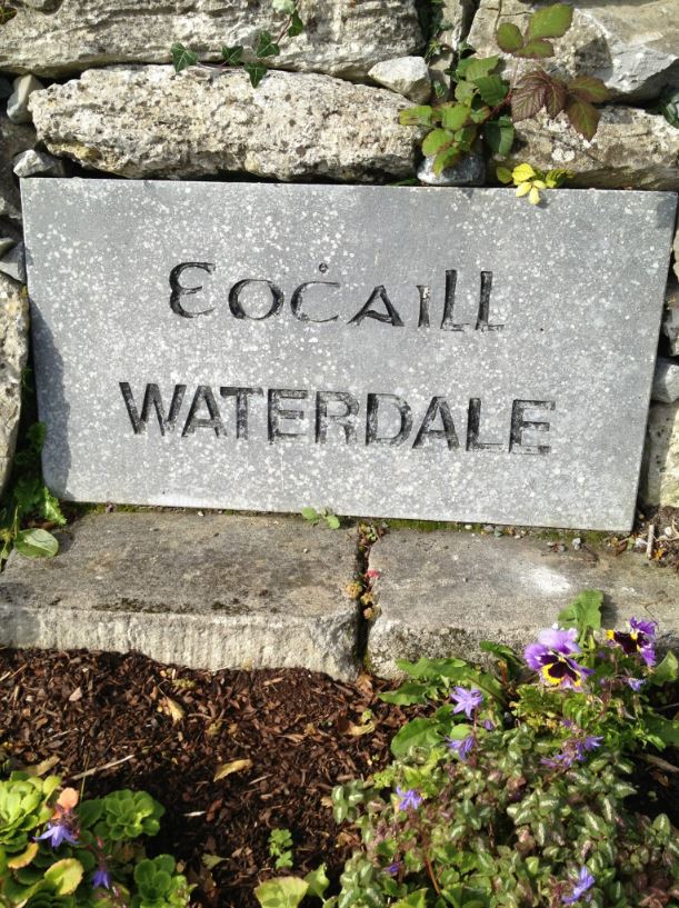
Name(s): oWaterdale and Oghill townlands.ie/waterdale
Gaeilge: Eochaill logainm.ie/waterdale
Meaning(s): Yew Wood
Description: Over half the land is of good quality with the remainder being bog or low-lying land liable to flooding.
Situated: The four milestone in the parish is situated near the entrance to Waterdale village. This stone is inscribed with the figure ‘7’, representing seven Irish miles to Eyre Square, Galway.
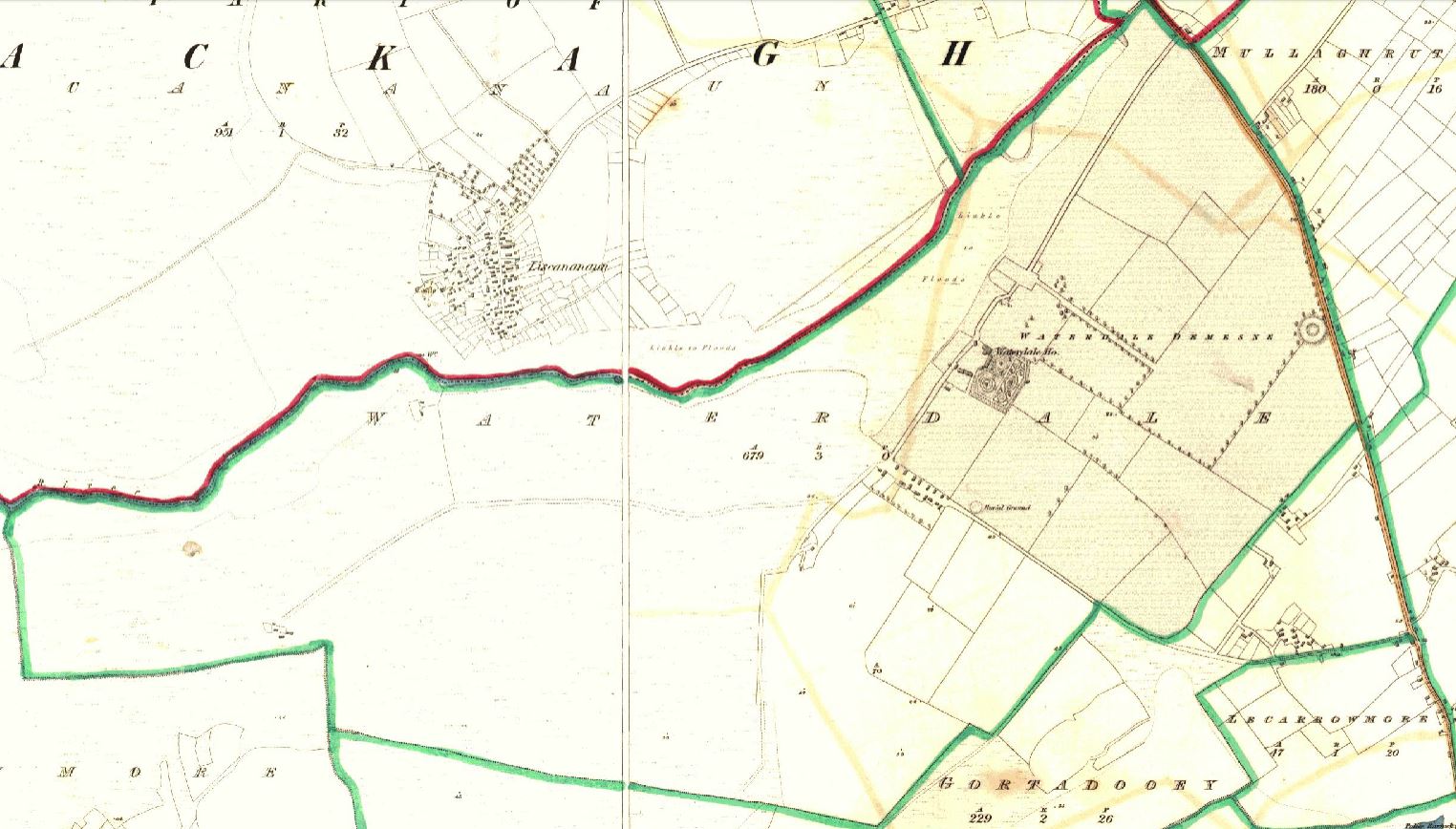
Sub-dominations: Leana Clocha, Baile na Móna, Páirc na Ceartan and Waterdale River
Boundaries-townland(s): Cloghaun, Gortadooey, Gortacloonmore andMullaghruttery (Claregalway) Carrheeny, Cloghaun and LIscananaun (Lackagh)
Civil & Church of Ireland Parish: Claregalway – Claregalway Civil Parish (John Grenham)
Barony: Clare – Connacht Baronies
District Electoral Division (DED): Claregalway – Map of Ireland
Poor Law Union (PLU): Galway (Poor Law Valuation) – Poor Law Unions (1851)
County: Galway – galway.ie
Diocese: The Diocese of Galway, Kilmacduagh and Kilfenora – Galway Rural
Province: Connacht(Connaught)
The Down Survey Map
(1650’s)
Search Down Survey Landowners/waterdale
O’Donovan’s field names book 1838
Search Rooaunmore
Families
: (Pre 1911)
Blake, Carley, Cullinan, Duggan, Glenane, Keaney, Moran, Walsh and Golding
Landlord(s)
James Staunton Lambert
Records
(Claregalway Parish)
Tithe Applotments (c1827)
The names of occupiers and the size of their agricultural holdings, over one acre only, in each townland. To determine the amount that they should pay in tithes to the Church of Ireland. (titheapplotmentbooks.nationalarchives.ie)
Search Claregalway
Roman Catholic Parish Registers
- Baptism (Claregalway 1849-1881): The Catholic Church’s collection of the parish baptismal registry. (registers.nli.ie)
- Marriage (Claregalway 1849-1883): The Catholic Church’s collection of the parish matrimonial registry. (registers.nli.ie)
- Burial (Claregalway 1849-1876): The Catholic Church’s collection of the parish burial registry. (registers.nli.ie)
Griffith Valuation’s
Primary Valuation of Ireland
A survey involving a detailed valuation of every taxable holding of agricultural or built property on the island of Ireland. Completed between 1864-1865 . Date of Publication for Claregalway was 1855. (askaboutireland.ie)
Search Waterdale
General Registry of Office (GRO) Records
- Civil Registery Birth: (1864-1915) The official State records of births in Ireland. (irishgenealogy.ie)
- Civil Registery Marriage: (1864-1940) The official State records of marriage in Ireland (irishgenealogy.ie)
- Civil Registery Death: (1864-1960) The official State records of death in Ireland (irishgenealogy.ie)
Census of Ireland (1821- 1911)
- 1821 vs 1831 (General Parish Population Only)
- 1831 (Summary of Returns for Claregalway Parish Only)
- 1841 (Summary of Returns for Parish Only)
- 1851 (Summary of Returns for Townlands Only)
- 1861 (Summary of Returns for Townlands Only)
- 1871 (Summary of Returns for Townlands Only)
- 1881 (Summary of Returns for Townlands Only)
- 1891 (Summary of Returns for Townlands Only)
- 1901 (Waterdale)
- 1911 (Waterdale)
Research
Index and Transcripts of memorials of deeds, conveyances and wills, 1708-1929
by Registry of Deeds, Dublin
familysearch.org/registryofdeeds/search/
Archaeological Survey of Ireland (ASI)
The Archaeological Survey of Ireland (ASI) is a unit of the National Monuments Service.
- Barrow – GA070-100
- Children’s burial ground (Lisheen)- GA070-101
archaeology.ie/historicenvironment/
More to Follow!
No Comments
Add a comment about this page