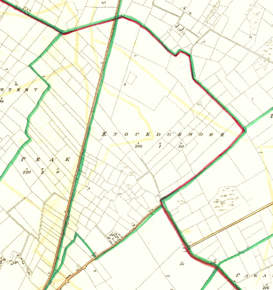
Knockdoemore


![]()
![]()
![]()
Description
The townland Knockdoemore in Claregalway and the townland of Knockdoe in the Parish Lackagh is at the place where the famous Battle of Knockdoe was fought in 1504.
Name(s): Knockdoemore townlands.ie/Knockdoemore
Gaeilge: Cnoc Tuadh Mór logainm.ie/Knockdoemore
Meaning(s): Hill of the big axe
Description: The land is mainly very good with some rocky outcrops.
Situated: Knockdoemore is situated to the east of the N17 at the top of the parish boundary. Tinkers Lane runs through Knockdoemore from the N17 to the Roscommon road. Baile Uí Chonaill has been associated a lot with the O’Connell families. Thomas Browne was the herdsman for the landlord in 1855.
Sub-dominations: Tinkers Lane and Baile Uí Chonaill
Boundaries-townland(s): Peake and Rooaunmore (Claregalway) Caraun, Knockdoebeg West and Knockdoemore East (Lackagh).
Civil & Church of Ireland Parish: Claregalway – Claregalway Civil Parish (John Grenham)
Barony: Clare – Connacht Baronies
District Electoral Division (DED): Claregalway – Map of Ireland
Poor Law Union (PLU): Galway (Poor Law Valuation) – Poor Law Unions (1851)
County: Galway – galway.ie
Diocese: The Diocese of Galway, Kilmacduagh and Kilfenora – Galway Rural
Province: Connacht(Connaught)
The Down Survey Map
(1650’s)
Search Down Survey Landowners/Knockdoemore
O’Donovan’s field names book 1838
Search Knockdoemore
Families
: (Pre 1911)
Bane, Browne, Comer, Connell, Lardner and Pearse
Landlord(s)
William Burke
Records
(Claregalway Parish)
Tithe Applotments (c1827)
The names of occupiers and the size of their agricultural holdings, over one acre only, in each townland. To determine the amount that they should pay in tithes to the Church of Ireland. (titheapplotmentbooks.nationalarchives.ie)
Search Claregalway
Roman Catholic Parish Registers
- Baptism (Claregalway 1849-1881): The Catholic Church’s collection of the parish baptismal registry. (registers.nli.ie)
- Marriage (Claregalway 1849-1883): The Catholic Church’s collection of the parish matrimonial registry. (registers.nli.ie)
- Burial (Claregalway 1849-1876): The Catholic Church’s collection of the parish burial registry. (registers.nli.ie)
Griffith Valuation’s
Primary Valuation of Ireland
A survey involving a detailed valuation of every taxable holding of agricultural or built property on the island of Ireland. Completed between 1864-1865 . Date of Publication for Claregalway was 1855. (askaboutireland.ie)
Search Knockdoemore
General Registry of Office (GRO) Records
- Civil Registery Birth: (1864-1915) The official State records of births in Ireland. (irishgenealogy.ie)
- Civil Registery Marriage: (1864-1940) The official State records of marriage in Ireland (irishgenealogy.ie)
- Civil Registery Death: (1864-1960) The official State records of death in Ireland (irishgenealogy.ie)
Census of Ireland (1821- 1911)
- 1821 vs 1831 (General Parish Population Only)
- 1831 (Summary of Returns for Claregalway Parish Only)
- 1841 (Summary of Returns for Parish Only)
- 1851 (Summary of Returns for Townlands Only)
- 1861 (Summary of Returns for Townlands Only)
- 1871 (Summary of Returns for Townlands Only)
- 1881 (Summary of Returns for Townlands Only)
- 1891 (Summary of Returns for Townlands Only)
- 1901 (Knockdoemore)
- 1911 (Knockdoemore)
Research
Index and Transcripts of memorials of deeds, conveyances and wills, 1708-1929
by Registry of Deeds, Dublin
familysearch.org/registryofdeeds/search/
Archaeological Survey of Ireland (ASI)
The Archaeological Survey of Ireland (ASI) is a unit of the National Monuments Service.
- Ringfort – GA070-083
NOTE: Battle of Knockdoe that took place in 1504 took place mostly in Knockdoebeg in the Parish of Lackagh. GA070-080
archaeology.ie/historicenvironment/
More to Follow!
No Comments
Add a comment about this page