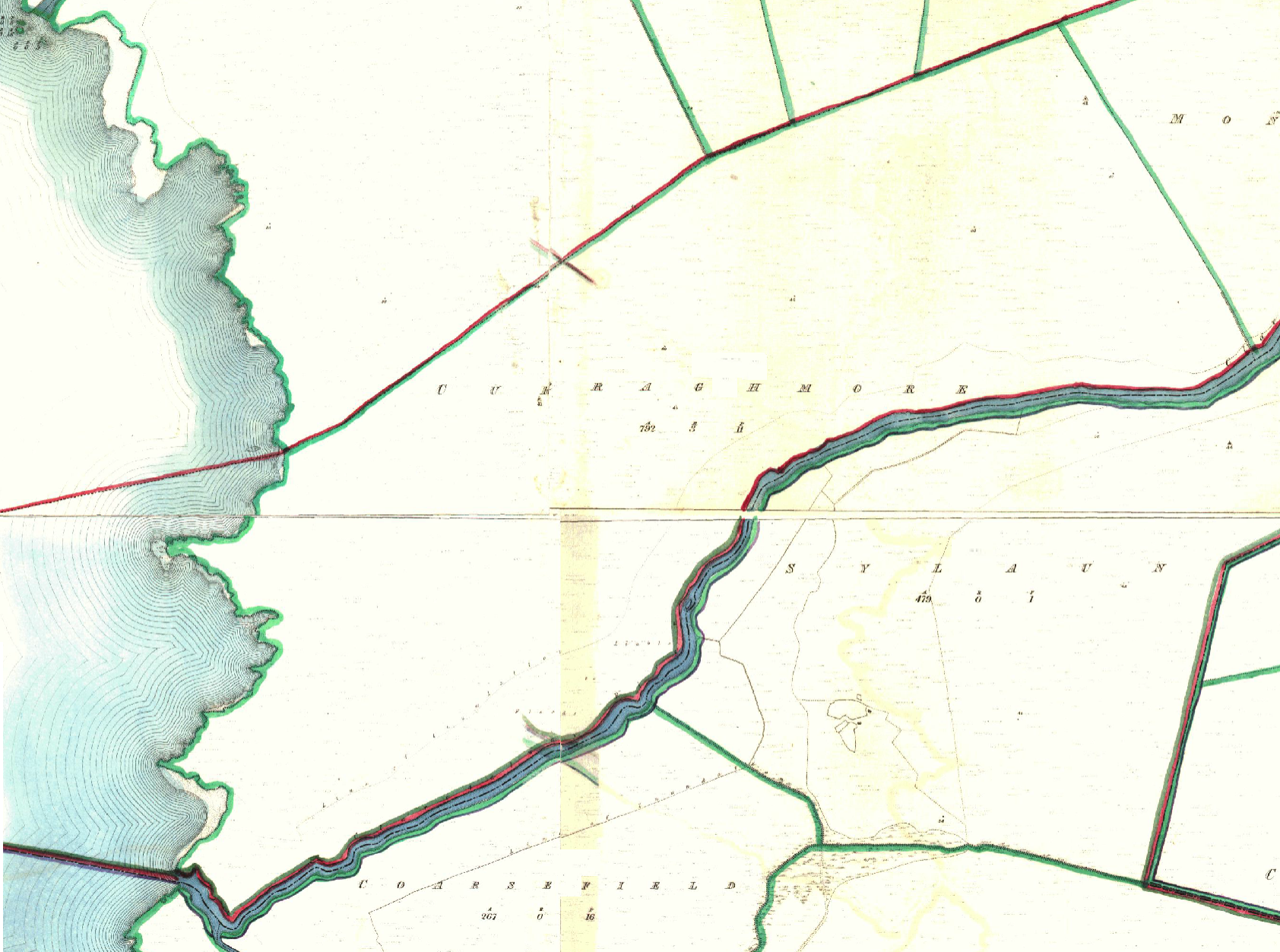
Curraghmore

![]()
![]()
![]()
Description
Now uninhabited
Name(s): Curraghmore townlands.ie/curraghmore
Gaeilge: Currach Mór logainm.ie/curraghmore
Meaning(s): Fort of the blacksmith or calves
Description: The land is mostly bog.
Situated: It is the most westerly townland in the parish and is beside Lough Corrib, it is where the mouth of the river Clare river into the Corrib.
Sub-domination(s): None
Boundaries-townland(s): Montiagh North (Claregalway), Addergoogle, Barranny, Cregduff and Lisheenanoran (Annaghdown) Coarsefield, Gortacallow and Sylaun (Oranmore)
Civil & Church of Ireland Parish: Claregalway – Claregalway Civil Parish (John Grenham)
Barony: Dunkellin – Connacht Baronies
District Electoral Division (DED): Claregalway – Map of Ireland
Poor Law Union (PLU): Galway (Poor Law Valuation) – Poor Law Unions (1851) Claregalway
County: Galway – galway.ie
Diocese: The Diocese of Galway, Kilmacduagh and Kilfenora – Galway Rural
Province: Connacht (Connaught)
The Down Survey Map
(1650’s)
Down Survey Landowners/curraghmore
O’Donovan’s field names book 1838
Families
: (Pre 1911)
Burke, Feeney
Landlord(s)
Lord Clanmorris (Bingham Family)
Records
(Claregalway Parish)
Tithe Applotments (c1827)
The names of occupiers and the size of their agricultural holdings, over one acre only, in each townland. To determine the amount that they should pay in tithes to the Church of Ireland. (titheapplotmentbooks.nationalarchives.ie)
Search Claregalway
Roman Catholic Parish Registers
- Baptism (Claregalway 1849-1881): The Catholic Church’s collection of the parish baptismal registry. (registers.nli.ie)
- Marriage (Claregalway 1849-1883): The Catholic Church’s collection of the parish matrimonial registry. (registers.nli.ie)
- Burial (Claregalway 1849-1876): The Catholic Church’s collection of the parish burial registry. (registers.nli.ie)
Griffith Valuation’s
Primary Valuation of Ireland
A survey involving a detailed valuation of every taxable holding of agricultural or built property on the island of Ireland. Completed between 1864-1865 . Date of Publication for Claregalway was 1855. (askaboutireland.ie)
Search Curraghmore
General Registry of Office (GRO) Records
- Civil Registery Birth: (1864-1915) The official State records of births in Ireland. (irishgenealogy.ie)
- Civil Registery Marriage: (1864-1940) The official State records of marriage in Ireland (irishgenealogy.ie)
- Civil Registery Death: (1864-1960) The official State records of death in Ireland (irishgenealogy.ie)
Census of Ireland (1821- 1911)
- 1821 vs 1831 (General Parish Population Only)
- 1831 (Summary of Returns for Claregalway Parish Only)
- 1841 (Summary of Returns for Parish Only)
- 1851 (Summary of Returns for Townlands Only)
- 1861 (Summary of Returns for Townlands Only)
- 1871 (Summary of Returns for Townlands Only)
- 1881 (Summary of Returns for Townlands Only)
- 1891 (Summary of Returns for Townlands Only)
- 1901 (Curraghmore)
- 1911 (Curraghmore, No families)
Research
Index and Transcripts of memorials of deeds, conveyances and wills, 1708-1929
by Registry of Deeds, Dublin
familysearch.org/registryofdeeds/search/
Archaeological Survey of Ireland (ASI)
The Archaeological Survey of Ireland (ASI) is a unit of the National Monuments Service.
No entry for the townland of Currahmore.
archaeology.ie/historicenvironment/
More to Follow!
No Comments
Add a comment about this page